Helene - Storm Updates
Monday, September 30, 2024, 3:30 PM Eastern Update:
ARRL leadership has been engaged throughout the weekend with key volunteers in the southeast, especially in hard hit North Carolina, to facilitate any support headquarters can provide to the impacted area. The devastation is widespread and greater than many seasoned emergency responders have ever seen before.
There are ad-hoc health and welfare nets that have popped up, parallel to official emergency communications efforts. Amateur radio operators in the area that have the means to communicate have been facilitating some level of traffic on several repeaters located on mountaintops in North and South Carolina.
High frequency (HF) ham bands are also being used, specifically 7232 KHz and 3923 KHz.
There are amateur radio operators working with several aviation relief organizations which mobilize general aviation aircraft donated by private owners to ferry in supplies. The challenge is widespread devastation of road networks to get anything in to the “last mile” of distribution.
ARRL remains ready to mobilize HamAid equipment as needed. HamAid is a supply of deployment-ready amateur radio gear that can be dispatched across the country within hours, providing amateur radio communications when local equipment has been lost or damaged due to a disaster.
Friday, September 27, 2024, 12:00 PM Eastern Update:
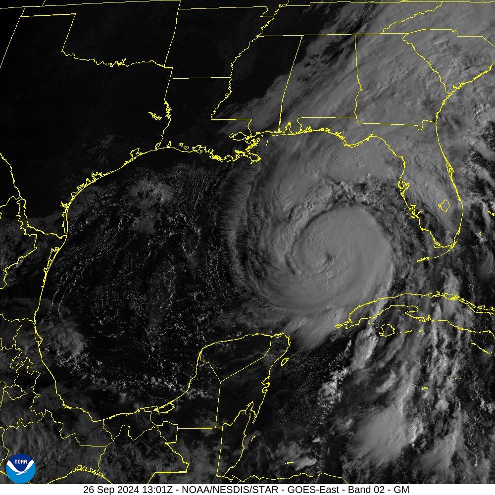
Hurricane Helene made landfall near Perry, Florida, on Thursday evening as a Category 4 storm. With winds of 140 miles per hour it’s the strongest hurricane on record to slam into Florida’s Big Bend.
More than 2.2 million customers don’t have power across Florida, Georgia, and the Carolinas, according to PowerOutage.US.
The National Hurricane Center reports the storm has weakened to a tropical storm as it moves father inland with winds of 70 miles per hour (mph) and is now located about 40 miles east of Macon Geogia and 100 miles Southeast of Atlanta, Georgia.
Helene is moving toward the north near 30 mph. A turn toward the north is expected this morning, taking the center over central and northeastern Georgia. After that, the storm is expected to turn northwestward and slow down over the Tennessee Valley later today and Saturday. Tropical-storm-force winds extend outward up to 275 miles mainly to the east of the center.
The Hurricane Watch Net closed operations for Hurricane Helene at 11:00 AM. During this 25-hour event, members of the Hurricane Watch Net collected and forwarded over 100 surface reports to the National Hurricane Center.
Tropical Storm John is forecast to move along the coast or just inland of southwestern Mexico later today and tonight. Catastrophic flash flooding and mudslides continue of portions of Southern and Southwestern Mexico.
The storm is moving northwest at 5 miles per hour and is expected to produce rainfall amounts of 10 to 20 inches across portions of the Mexican States of Guerrero and Michoacán. Additional rainfall of 2 to 4 inches with locally up to 6 inches expected across the Mexican states of Colima and western Oaxaca.
Thursday, September 26, 2024, 9:30 PM Eastern Update:
Hurricane Helene is now a Category 4 storm with sustained winds of 130 MPH. Amateur Radio volunteers with groups such as the ARRL® Amateur Radio Emergency Service® (ARES®) are activated throughout the area being impacted. ARES members are embedded in emergency operations centers across Florida, providing critical communications to served agencies.
ARRL Director of Emergency Management Josh Johnston, KE5MHV, has been in meetings with key leaders from across the ARRL Field Organization Thursday Evening. He is closely monitoring the situation, and ready to provide any support needed to the field. "This is a major storm, and it is intensifying as it moves ashore. We are expecting impacts well inland," he said.
ARRL sections as far north as Tennessee and Kentucky are expecting to be impacted by Hurricane Helene.
Thursday, September 26, 2024, 2:45 PM Eastern Update:
As of Thursday afternoon September 26, 2024, Hurricane Helene was upgraded to a Category 3 storm by the National Hurricane Center. It is expected to strengthen and bring catastrophic winds and storm surge to the northeastern Gulf coast. Late Thursday afternoon Helene was located about 225 miles from Tampa, Florida, with winds of 120 miles per hour (mph).
The storm is moving toward the north-northeast near 16 mph. This general motion is expected to continue with a significant increase in forward speed during the next 24 hours. On the forecast track, Helene will move across the eastern Gulf of Mexico Thursday and cross the Florida Big Bend coast Thursday evening or early Friday morning, possibly as a category 3 or 4 storm. After landfall, Helene is expected to turn northwestward and slow down over the Tennessee Valley on Friday and Saturday. Weakening is expected after landfall, but Helene's fast forward speed will allow strong, damaging winds, especially in gusts, to penetrate well inland across the southeastern United States, including over the higher terrain of the southern Appalachians.
This story will be updated.
Thursday, September 26, 2024, 9:00 AM Eastern Update:
Hurricane Helene has been upgraded to a Category 2 storm by the National Hurricane Center. It is expected to strengthen and bring catastrophic winds and storm surge to the northeastern Gulf coast. At 8:00 AM Thursday morning, Helene was located about 320 miles from Tampa, Florida, with winds of 100 miles per hour (mph).
The storm is moving toward the north-northeast near 12 mph. This general motion is expected to continue with a significant increase in forward speed during the next 24 hours. On the forecast track, Helene will move across the eastern Gulf of Mexico Thursday and cross the Florida Big Bend coast Thursday evening or early Friday morning. After landfall, Helene is expected to turn northwestward and slow down over the Tennessee Valley on Friday and Saturday. Weakening is expected after landfall, but Helene's fast forward speed will allow strong, damaging winds, especially in gusts, to penetrate well inland across the southeastern United States, including over the higher terrain of the southern Appalachians.
The Hurricane Watch Net will activate Thursday morning at 10:00 AM EDT on both 14.325 MHz and 7.268 MHz. Here are the current plans, from HWN:
Thursday Activation
• 20 meters: 14.325 MHz (USB) at 10:00 AM EDT (1400 UTC) until we lose propagation at night.
• 40 meters: 7.268 MHz (LSB) at 10:00 AM EDT (1400 UTC). We will remain active on this frequency throughout the day and overnight for as long as propagation allows. If propagation allows us to operate all night, we will suspend operations at 7:30 AM EDT Friday to allow the Waterway Net to conduct their daily net.
Friday Activation
• 20 meters: we will resume operations on 14.325 MHz at 7:00 AM EDT (1000 UTC).
• 40 meters: we will resume operations on 7.268 MHz at 8:30 AM EDT (1230 UTC).
Any change to the Hurricane Watch Net plans will be on their website,www.hwn.org, and social media page.
The VoIP Hurricane Net will activate at 10 AM EDT Thursday and remain active for as long as necessary for Hurricane Helene and impacts to Florida and Georgia, through Friday morning. The net, on *WX_TALK* EchoLink conference node: 7203/IRLP 9219 system and other VoIP radio systems via the KC5FM-R node, is supporting WX4NHC, the amateur radio station at the National Hurricane Center in Miami, Florida. WX4NHC will also be active beginning at 3 PM EDT Thursday through late Thursday evening.
The ARRL West Central Florida Section will be activating both the State EOC at Tallahassee (KA4EOC) and an alternative communications point at the Escambia County Emergency Operations Center (W4UC.)
Current planned ICS 205 activation:
SARNET should be used as the primary communications point except for any sensitive traffic.
Note that if the microwave link is lost along the way, it may impact communications if the transmission can’t reach the central routing point
If using Winlink, formal for messaging traffic and should be sent to either KA4EOC for ham or NNA4FL for SHARES. Winlink is monitored as well as configured to automatically forward to the State Watch Office:
· For HF, 7197 for daytime and 3940 for night primary (KA4EOC & W4UC will share responsibility for monitoring the frequencies)
· No time has been set to place SARNET in a restricted net or when the HF net will begin, but that information will be shared soon. Activation of the formal nets will not begin until storm impacts start being felt in the state.
ARRL will report current updates and amateur radio activations as the storms move inward.
Wednesday, September 25, 2024 12:00 PM Eastern Update:
Amateur radio continues to respond to two different tropical events as of Wednesday, September 25, 2024, at 12:00 PM Eastern, now Hurricane Helene and Tropical Depression John
The National Hurricane Center reports that Tropical Storm Helene has been upgraded to a Category 1 Hurricane with 80 mph winds and is forecast to keep rapidly intensifying into a Category 3 hurricane by the time it makes landfall in Florida’s Big Bend by Thursday evening.
The Tropical Storm Warning has been extended northward to Altamaha Sound, Georgia. On the forecast track, the center of Helene will pass near the northeastern coast of the Yucatan Peninsula this morning, move across the eastern Gulf of Mexico later today and Thursday. Over the southeastern U.S., Helene is expected to produce total rain accumulations of 5 to 10 inches with isolated totals around 15 inches. This rainfall will likely result in areas of considerable flash and urban flooding, with areas of significant river flooding.
A tornado or two may occur tonight over parts of the western Florida peninsula and southern Alabama. The risk of tornadoes will increase on Thursday, expanding across Florida and into parts of Georgia and South Carolina.
The National Hurricane Center now reports that Hurricane John has dissipated into a tropical depression after hitting Mexico’s Pacific coast, making landfall about 80 miles east of the resort of Acapulco. It was downgraded on Tuesday to a tropical depression with maximum sustained wind speeds of 35 miles per hour (mph). Mexican authorities have discontinued all tropical storm warnings.
The activation for schedule for the VoIP Hurricane Net and WX4NHC and The Hurricane Watch Net has not changed.
The VoIP Hurricane Net and WX4NHC, the amateur radio station at the National Hurricane Center, will activate Thursday morning through Friday morning on the *WX_TALK* Echolink conference node: 7203/IRLP 9219 reflector system for Helene and impacts to Florida and Georgia. The net activation announcement will be posted by Wednesday afternoon.
The Hurricane Watch Net is making tentative plans to activate Thursday for what is expected to be Hurricane Helene, currently forecast to be a Category 3 hurricane at landfall. With its fast forward speed, it is expected to remain a hurricane well into southern Georgia before weakening to a tropical storm.
HWN Activation Plans:
Thursday
- 20 meters: 14.325 MHz (USB) at 10:00 AM EDT (1400 UTC) until losing propagation at night.
- 40 meters: 7.268 MHz (LSB) at 10:00 AM EDT (1400 UTC). The net will remain active on this frequency throughout the day and overnight for as long as propagation allows. If propagation allows us to operate all night, we will suspend operations at 7:30 AM EDT Friday to allow the Waterway Net to conduct its daily net.
Friday
- 20 meters: Net will resume operations on 14.325 MHz at 7:00 AM EDT (1000 UTC).
- 40 meters: Net will resume operations on 7.268 MHz at 8:30 AM EDT (1230 UTC).
Any change to the Hurricane Watch Net plans will be on their website,www.hwn.org, and social media page.
ARRL will report current updates and amateur radio activations as the storms move inward.
Wednesday, September 25, 2024 11:00 AM Eastern Update:
Helene has been upgraded to a Category 1 Hurricane. The storm has sustained winds of 80 miles per hour.
Wednesday, September 25, 2024 9:30 AM Eastern Update:
Amateur radio continues to respond to two different tropical events as of Wednesday, September 25, 2024, at 7:00 AM Eastern, Tropical Depression John and Tropical Storm Helene.
The National Hurricane Center now reports that Hurricane John has dissipated into a tropical depression after hitting Mexico’s Pacific coast, making landfall about 80 miles east of the resort of Acapulco. It was downgraded on Tuesday to a tropical depression with maximum sustained wind speeds of 35 miles per hour (mph). Mexican authorities have discontinued all tropical storm warnings.
The National Hurricane Center also reports that Tropical Storm Helene continues to move northwest at 9 miles per hour. As of 7:00 AM Wednesday September 25, 2024, Helene is just off the northeastern coast of the Yucatan Peninsula, about 60 miles east northeast of Cozumel, Mexico. Sustained winds are 70 mph.
The Tropical Storm Warning has been extended northward to Altamaha Sound, Georgia. On the forecast track, the center of Helene will pass near the northeastern coast of the Yucatan Peninsula this morning, move across the eastern Gulf of Mexico later today and Thursday, and reach the Big Bend coast of Florida late Thursday. Over the southeastern U.S., Helene is expected to produce total rain accumulations of 5 to 10 inches with isolated totals around 15 inches. This rainfall will likely result in areas of considerable flash and urban flooding, with areas of significant river flooding.
A tornado or two may occur tonight over parts of the western Florida peninsula and southern Alabama. The risk of tornadoes will increase on Thursday, expanding across Florida and into parts of Georgia and South Carolina.
The VoIP Hurricane Net and WX4NHC, the amateur radio station at the National Hurricane Center, will activate Thursday morning through Friday morning on the *WX_TALK* Echolink conference node: 7203/IRLP 9219 reflector system for Helene and impacts to Florida and Georgia. The net activation announcement will be posted by Wednesday afternoon.
The Hurricane Watch Net is making tentative plans to activate Thursday for what is expected to be Hurricane Helene, currently forecast to be a Category 3 hurricane at landfall. With its fast forward speed, it is expected to remain a hurricane well into southern Georgia before weakening to a tropical storm.
HWN Activation Plans:
Thursday
- 20 meters: 14.325 MHz (USB) at 10:00 AM EDT (1400 UTC) until losing propagation at night.
- 40 meters: 7.268 MHz (LSB) at 10:00 AM EDT (1400 UTC). The net will remain active on this frequency throughout the day and overnight for as long as propagation allows. If propagation allows us to operate all night, we will suspend operations at 7:30 AM EDT Friday to allow the Waterway Net to conduct its daily net.
Friday
- 20 meters: Net will resume operations on 14.325 MHz at 7:00 AM EDT (1000 UTC).
- 40 meters: Net will resume operations on 7.268 MHz at 8:30 AM EDT (1230 UTC).
Any change to the Hurricane Watch Net plans will be on their website,www.hwn.org, and social media page.
ARRL will report current updates and amateur radio activations as the storms move inward.
Tuesday, September 24, 2024 Afternoon Update:Amateur radio is responding to two different tropical events as of Tuesday, September 24, 2024 at 1:00 PM Eastern.
Hurricane John
The National Hurricane Center reports that Hurricane John made landfall on Mexico's southern Pacific coast late Monday evening about 80 miles east of the resort of Acapulco as a Category 3 storm. Winds were reported up to 120 miles per hour (mph) before the storm began weakening back to tropical storm status early Tuesday. Life-threatening flash flooding is expected across portions of southern Mexico during the next few days.
Tropical Storm Helena
Meanwhile, hurricane and storm surge watches cover much of the Gulf Coast of Florida Tuesday morning as a system churning in the Caribbean Sea was just designated as Tropical Storm Helene and is projected to strengthen into a major storm. Residents should ensure they have their hurricane plan in place and also follow the advice given by local officials.
Florida declared a state of emergency for 41 counties along and near the state's Gulf Coast because of threats from the storm. If the storm makes landfall as a hurricane, it would be the fourth landfalling hurricane in the mainland U.S. this year, joining Beryl, Debby, and Francine.
The Hurricane Watch Net is making tentative plans to activate Thursday for what is expected to be Hurricane Helene, currently forecasted to be a Category 3 hurricane at landfall. With its fast forward speed, it is expected to remain a hurricane well into southern Georgia before weakening to a tropical storm.
HWN Activation Plans:
Thursday
- 20 meters: 14.325 MHz (USB) at 10:00 AM EDT (1400 UTC) until we lose propagation at night.
- 40 meters: 7.268 MHz (LSB) at 10:00 AM EDT (1400 UTC). We will remain active on this frequency throughout the day and overnight for as long as propagation allows. If propagation allows us to operate all night, we will suspend operations at 7:30 AM EDT Friday to allow the Waterway Net to conduct their daily net.
Friday
- 20 meters: we will resume operations on 14.325 MHz at 7:00 AM EDT (1000 UTC).
- 40 meters: we will resume operations on 7.268 MHz at 8:30 AM EDT (1230 UTC).
Any change to the Hurricane Watch Net plans will be on their website, www.hwn.org, and social media page.
ARRL will report current updates and amateur radio activations as the storms move inward.
Photo Gallery
-
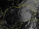 Visible Image of ...
-
![Hurricane John [NOAA image]](/img/130x97/exact/News/hurricane john NOAA photo 9-24-24.jpg) Hurricane John [N...
Hurricane John [N...
![Hurricane John [NOAA image]](/images/view/News/hurricane john NOAA photo 9-24-24.jpg)
Back


